Every plan is a drawing.
Until you stand on it.
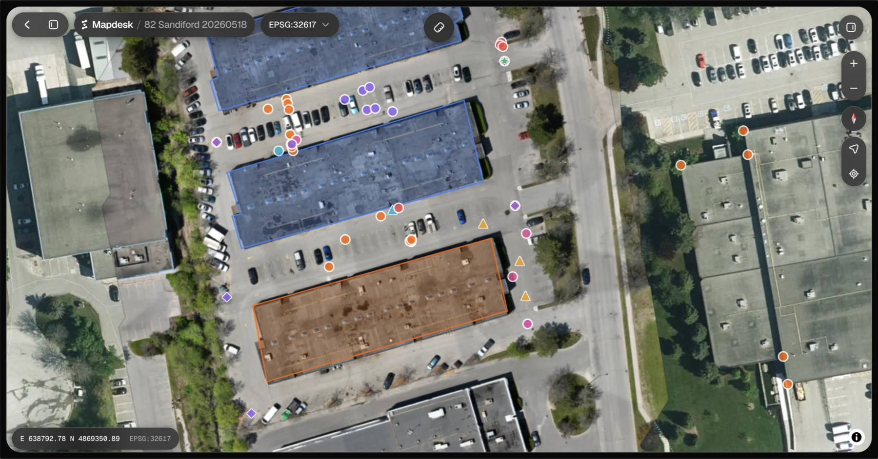
Your drawing, laid out on the actual ground, from the phone already in your pocket.
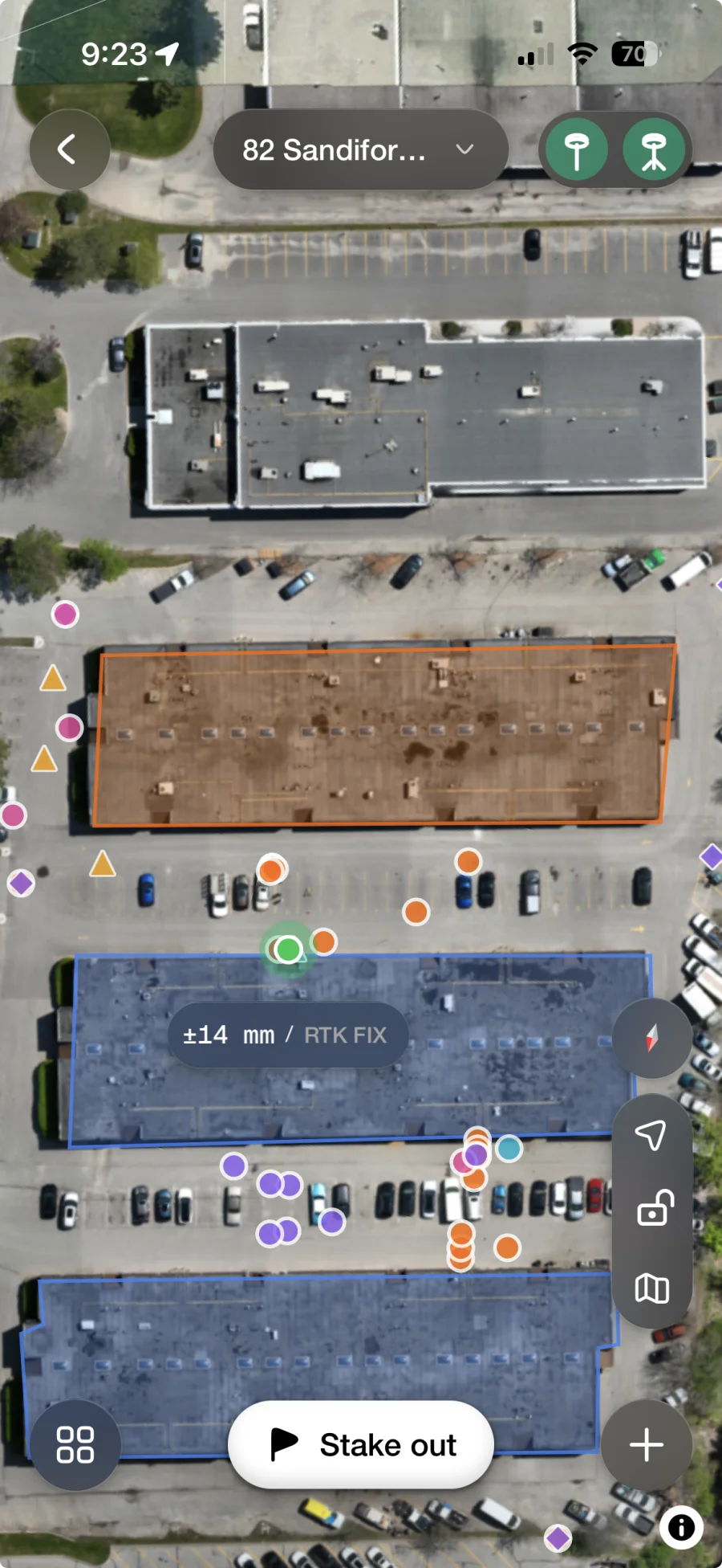
Get the highlights.
Your plan, at full scale
Drawn on the ground in front of you, in the place it describes — not on a screen you translate from.
Walk to any point
Tap it and the screen takes you there. You'll know the moment you're standing on it.
It shows its accuracy
The live figure is on screen the whole time. You decide whether it's good enough for this point.
Quick, Standard, Precise
Five seconds, thirty, or three minutes on a point. You choose how sure you need to be.
Pairs with your rover
Bluetooth to the receiver already in your truck. No cradle, no adapter, no second app.
Nothing to export
Every capture is at the desk before you've packed up. No card, no cable, no naming files.
You can read a plan anywhere.
Except the one place it describes.
A drawing is relative. It only means anything next to other things on the sheet. None of those are in the field with you.
So the job becomes translation. Tape measures, offsets, someone holding the other end.
Mapdesk removes that step. The drawing goes on the ground at full scale, while you stand in it.
What's left is the actual work. Go to the spot. Check it. Mark it.
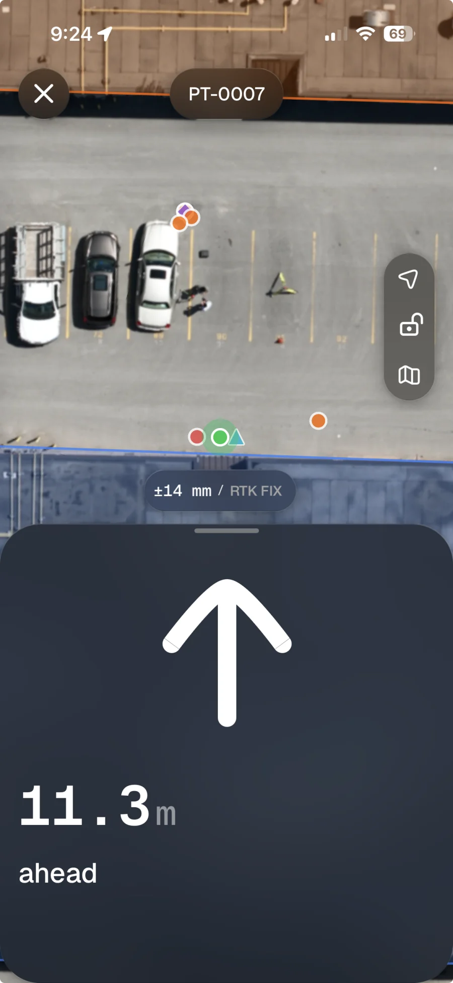
Walk to any point.
Know when you're on it.
Pick a point. The screen takes you to it, then tells you when you're on it. No tape, no offsets, no second person.
Record what's really there.
Not what the drawing assumed.
Drop a point where you stand and Mapdesk keeps it. Add the things the drawing never knew about.
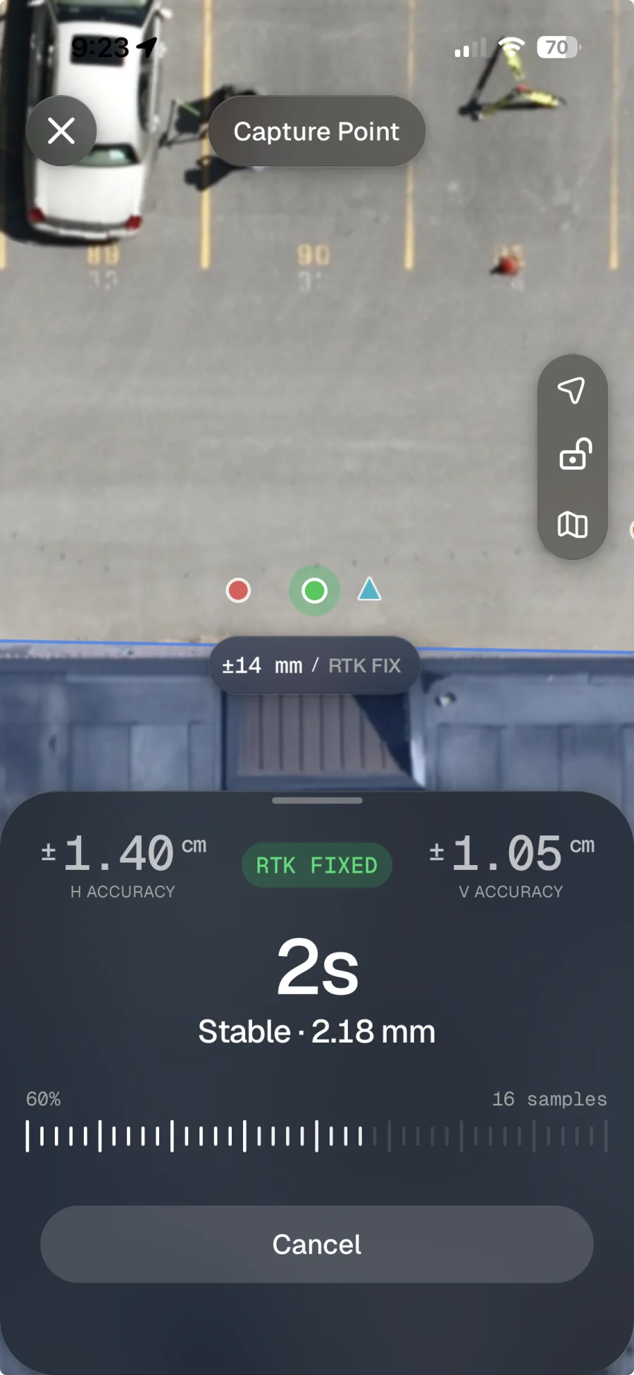
A busy job,
still readable.
Colour every layer your way and switch drawings on and off, so four revisions don't become one mess.
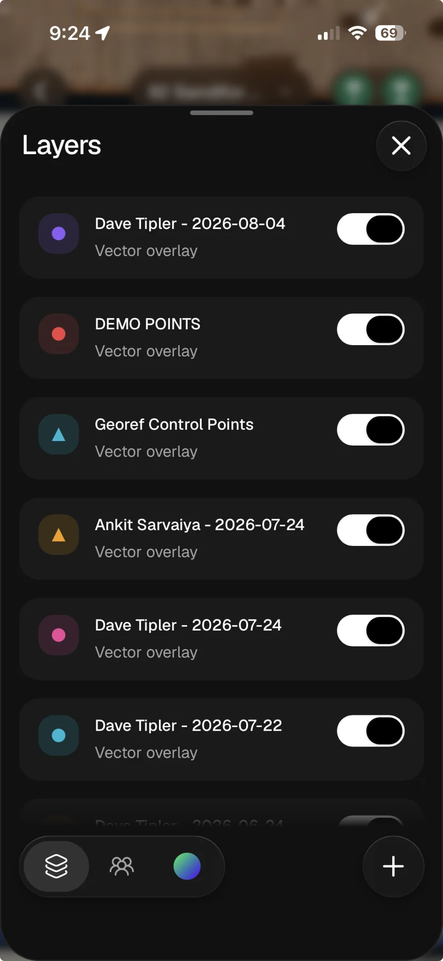
It tells you when to trust it.
And when not to.
You don't have to know anything about GPS to know whether this point is good.
Steady
Hold still and it stops moving. Keep the point.
Drifting
It's wandering. Wait a moment before you save.
Moving
You moved, or the sky did. Don't keep this one.
The number never hides. Live accuracy stays on screen while you work.
Take longer when it matters. Seconds for a rough point, minutes for a corner.
Waiting doesn't fake it. Longer proves a point is steady. It never shrinks the error.
It's at the desk
before you are.
The part nobody advertises is what happens after five. With Mapdesk, nothing does.
Nothing to export. Points land in the project on Mapdesk web as you take them, named the way you named them.
Nothing to name. No folder of numbered files to decode on Monday. It arrives already organised.
Nothing to wait for. The office can watch the job fill in while the crew is still standing on it.
Take it to the ground.
Bring the drawing, walk the place it describes, and put every point exactly where it belongs.



- 1.Accuracy shown in the app is the figure the connected receiver is reporting at that moment. It varies with sky view, baseline length and correction source.
- 2.Occupation profiles are a quality gate, not an averaging step: holding a point longer establishes whether a reading is stable, it does not reduce systematic error.